
Sector 20 topographic map
Interactive map
Click on the map to display elevation.
About this map
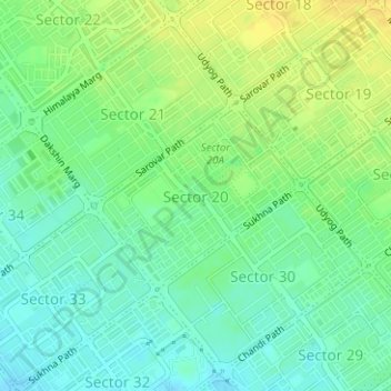
Name: Sector 20 topographic map, elevation, terrain.
Location: Sector 20, Ward 16, Chandigarh, 160020, India (30.71475 76.77335 30.72767 76.79005)
Average elevation: 339 m
Minimum elevation: 328 m
Maximum elevation: 351 m
Other topographic maps
Click on a map to view its topography, its elevation and its terrain.
Chandigarh
India > Chandigarh > Chandigarh > Chandigarh
Chandigarh, 160018, India
Average elevation: 378 m