
Leest topographic map
Interactive map
Click on the map to display elevation.
About this map
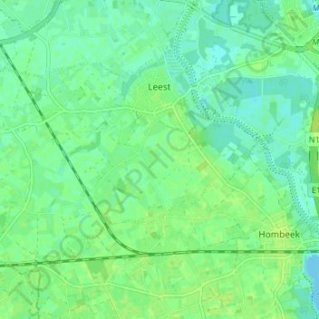
Name: Leest topographic map, elevation, terrain.
Location: Leest, Mechelen, Antwerp, Flanders, Belgium (51.01060 4.37009 51.04054 4.43607)
Average elevation: 6 m
Minimum elevation: -1 m
Maximum elevation: 12 m