
Kankra topographic map
Interactive map
Click on the map to display elevation.
About this map
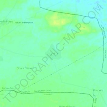
Name: Kankra topographic map, elevation, terrain.
Location: Kankra, Buhana Tehsil, Jhunjhunun, Rajasthan, India (28.16075 76.03363 28.20075 76.07363)
Average elevation: 294 m
Minimum elevation: 287 m
Maximum elevation: 304 m