
Buck Creek topographic map
Interactive map
Click on the map to display elevation.
About this map
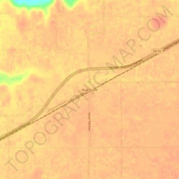
Name: Buck Creek topographic map, elevation, terrain.
Location: Buck Creek, Tippecanoe County, Indiana, 47924, United States (40.46781 -86.78140 40.50781 -86.74140)
Average elevation: 202 m
Minimum elevation: 164 m
Maximum elevation: 209 m
Other topographic maps
Click on a map to view its topography, its elevation and its terrain.
West Lafayette
United States > Indiana > Tippecanoe County
West Lafayette, Tippecanoe County, Indiana, United States
Average elevation: 192 m
Happy Hollow Heights
United States > Indiana > Tippecanoe County > West Lafayette > Happy Hollow Heights
Happy Hollow Heights, West Lafayette, Tippecanoe County, Indiana, 46906, United States
Average elevation: 189 m
Lafayette
United States > Indiana > Tippecanoe County > Lafayette
Lafayette, Tippecanoe County, Indiana, United States
Average elevation: 193 m