
Izier topographic map
Interactive map
Click on the map to display elevation.
About this map
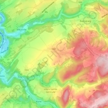
Name: Izier topographic map, elevation, terrain.
Location: Izier, Durbuy, Marche-en-Famenne, Luxembourg, Wallonia, Belgium (50.36454 5.54407 50.39948 5.63730)
Average elevation: 250 m
Minimum elevation: 123 m
Maximum elevation: 386 m