
Wedderburn topographic map
Interactive map
Click on the map to display elevation.
About this map
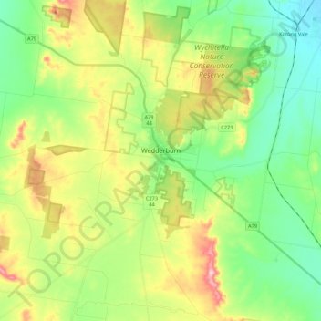
Name: Wedderburn topographic map, elevation, terrain.
Location: Wedderburn, Shire of Loddon, Victoria, 3518, Australia (-36.51203 143.50588 -36.33773 143.69197)
Average elevation: 206 m
Minimum elevation: 135 m
Maximum elevation: 334 m