
Catonsville topographic map
Interactive map
Click on the map to display elevation.
About this map
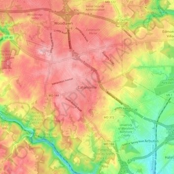
Name: Catonsville topographic map, elevation, terrain.
Average elevation: 104 m
Minimum elevation: 10 m
Maximum elevation: 170 m
Other topographic maps
Click on a map to view its topography, its elevation and its terrain.
Catonsville
United States > Maryland > Baltimore County > Catonsville
Catonsville, Baltimore County, Maryland, United States
Average elevation: 105 m