
Golub-Dobrzyń County topographic map
Interactive map
Click on the map to display elevation.
About this map
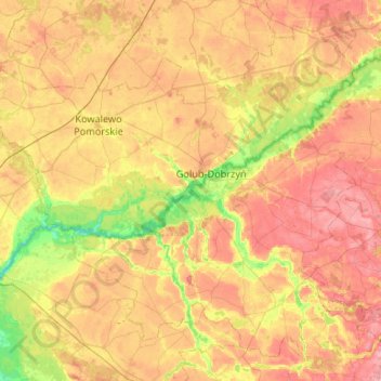
Name: Golub-Dobrzyń County topographic map, elevation, terrain.
Location: Golub-Dobrzyń County, Kuyavian-Pomeranian Voivodeship, Poland (52.96071 18.72740 53.23768 19.25686)
Average elevation: 93 m
Minimum elevation: 40 m
Maximum elevation: 143 m