
Bagdara WLS topographic map
Interactive map
Click on the map to display elevation.
About this map
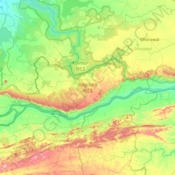
Name: Bagdara WLS topographic map, elevation, terrain.
Location: Bagdara WLS, Lalganj, Mirzapur District, Uttar Pradesh, India (24.52160 82.38032 24.70269 82.94519)
Average elevation: 279 m
Minimum elevation: 150 m
Maximum elevation: 567 m