
Saharsa topographic map
Interactive map
Click on the map to display elevation.
About this map
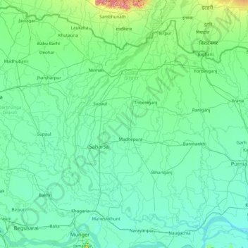
Name: Saharsa topographic map, elevation, terrain.
Location: Saharsa, Madhepura, Bihar, India (25.30000 86.05000 26.70000 87.45000)
Average elevation: 54 m
Minimum elevation: 24 m
Maximum elevation: 394 m