
Nālanda topographic map
Interactive map
Click on the map to display elevation.
About this map
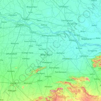
Name: Nālanda topographic map, elevation, terrain.
Location: Nālanda, Nalanda, Bihar, 803119, India (24.55000 84.88333 25.95000 86.28333)
Average elevation: 84 m
Minimum elevation: 33 m
Maximum elevation: 638 m