
Brooklyn topographic map
Interactive map
Click on the map to display elevation.
About this map
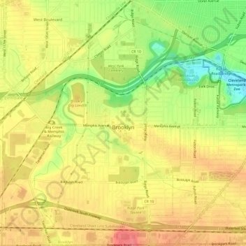
Name: Brooklyn topographic map, elevation, terrain.
Location: Brooklyn, Cuyahoga County, Ohio, 44144, United States (41.41841 -81.76966 41.46252 -81.72866)
Average elevation: 230 m
Minimum elevation: 188 m
Maximum elevation: 257 m