
Skowhegan topographic map
Interactive map
Click on the map to display elevation.
About this map
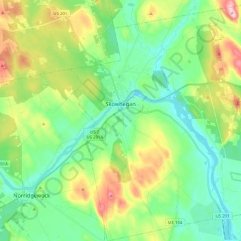
Name: Skowhegan topographic map, elevation, terrain.
Location: Skowhegan, Somerset County, Maine, United States (44.68690 -69.75999 44.82438 -69.58099)
Average elevation: 101 m
Minimum elevation: 29 m
Maximum elevation: 260 m
According to the United States Census Bureau, the town has a total area of 60.47 square miles (156.62 km2), of which 58.85 square miles (152.42 km2) is land and 1.62 square miles (4.20 km2) is water. Skowhegan is drained by the Wesserunsett Stream and Kennebec River. Loomis Hill, elevation 870 feet (265 meters) above sea level, is the highest point in town.
Other topographic maps
Click on a map to view its topography, its elevation and its terrain.
Parlin Pond
United States > Maine > Somerset County > Parlin Pond Township
Parlin Pond, Parlin Pond Township, Somerset County, Maine, United States
Average elevation: 529 m
Gray Island
United States > Maine > Somerset County > Solon
Gray Island, Solon, Somerset County, Maine, United States
Average elevation: 105 m
Mackamp
United States > Maine > Somerset County
Mackamp, Long Pond Township, Somerset County, Maine, United States
Average elevation: 395 m
West Forks Plantation
United States > Maine > Somerset County
West Forks Plantation, Somerset County, Maine, 04985, United States
Average elevation: 387 m
Fairfield
United States > Maine > Somerset County
Fairfield, Somerset County, Maine, United States
Average elevation: 64 m
Madison
United States > Maine > Somerset County
Madison, Somerset County, Maine, 04950, United States
Average elevation: 124 m
Norris Brook
United States > Maine > Somerset County
Norris Brook, T5 R18 WELS, Somerset County, Maine, United States
Average elevation: 420 m
Bigelow Hill
United States > Maine > Somerset County > Skowhegan
Bigelow Hill, Skowhegan, Somerset County, Maine, United States
Average elevation: 158 m
Smithfield
United States > Maine > Somerset County > Smithfield
Smithfield, Somerset County, Maine, 04978, United States
Average elevation: 105 m
Ham Hill
United States > Maine > Somerset County > Cambridge
Ham Hill, Cambridge, Somerset County, Maine, 04923, United States
Average elevation: 188 m