
Roslyn topographic map
Interactive map
Click on the map to display elevation.
About this map
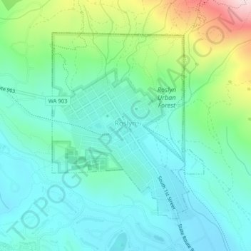
Name: Roslyn topographic map, elevation, terrain.
Location: Roslyn, Kittitas County, Washington, 98941, United States (47.21365 -121.00575 47.23366 -120.98172)
Average elevation: 742 m
Minimum elevation: 650 m
Maximum elevation: 1,026 m