
Katamdag topographic map
Interactive map
Click on the map to display elevation.
About this map
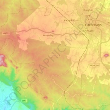
Name: Katamdag topographic map, elevation, terrain.
Location: Katamdag, Hazaribagh, Jharkhand, India (23.87737 85.19847 24.02037 85.37091)
Average elevation: 600 m
Minimum elevation: 407 m
Maximum elevation: 774 m