
Mansores topographic map
Interactive map
Click on the map to display elevation.
About this map
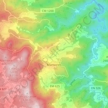
Name: Mansores topographic map, elevation, terrain.
Location: Mansores, Arouca, Aveiro, 4540-606, Portugal (40.91168 -8.38949 40.96055 -8.33391)
Average elevation: 342 m
Minimum elevation: 111 m
Maximum elevation: 628 m