
Covington topographic map
Interactive map
Click on the map to display elevation.
About this map
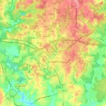
Name: Covington topographic map, elevation, terrain.
Location: Covington, Newton County, Georgia, 30014, United States (33.55740 -83.89016 33.65083 -83.79930)
Average elevation: 219 m
Minimum elevation: 169 m
Maximum elevation: 266 m
Other topographic maps
Click on a map to view its topography, its elevation and its terrain.
Hightower Forest
United States > Georgia > Newton County > Hightower Forest
Hightower Forest, Newton County, Georgia, United States
Average elevation: 225 m