
South Pass topographic map
Interactive map
Click on the map to display elevation.
About this map
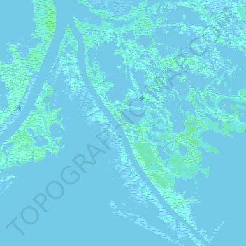
Name: South Pass topographic map, elevation, terrain.
Location: South Pass, Plaquemines Parish, Louisiana, United States (29.00239 -89.25381 29.15784 -89.15032)
Average elevation: 0 m
Minimum elevation: -5 m
Maximum elevation: 7 m
Other topographic maps
Click on a map to view its topography, its elevation and its terrain.
Belle Chasse
United States > Louisiana > Plaquemines Parish
Belle Chasse, Plaquemines Parish, Louisiana, 70037, United States
Average elevation: 1 m
Woodland
United States > Louisiana > Plaquemines Parish > Woodland
Woodland, Plaquemines Parish, Louisiana, 70082, United States
Average elevation: 0 m