
Kettleburgh topographic map
Interactive map
Click on the map to display elevation.
About this map
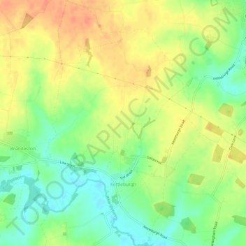
Name: Kettleburgh topographic map, elevation, terrain.
Location: Kettleburgh, East Suffolk, Suffolk, England, United Kingdom (52.18360 1.29466 52.21977 1.33168)
Average elevation: 39 m
Minimum elevation: 16 m
Maximum elevation: 60 m