
Adair topographic map
Interactive map
Click on the map to display elevation.
About this map
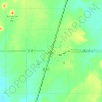
Name: Adair topographic map, elevation, terrain.
Location: Adair, Mayes County, Oklahoma, 74330, United States (36.42344 -95.29204 36.45237 -95.20534)
Average elevation: 206 m
Minimum elevation: 190 m
Maximum elevation: 235 m
Adair lies 10 miles (16 km) north of Pryor on U.S. Route 69 in Mayes County. The city is in the northeastern portion of the state known as "Green Country" and is near the borders of Kansas, Missouri, and Arkansas. Adair's geographic coordinates are 36°26′13″N 95°15′45″W / 36.43694°N 95.26250°W / 36.43694; -95.26250 (36.436910, -95.262546) with an elevation of 640 ft (200 m) above sea level. According to the United States Census Bureau, the town has a total area of 4.5 square miles (12 km2), all land.