
Culloden Battlefield topographic map
Interactive map
Click on the map to display elevation.
Culloden Battlefield
Since 2001, the site of the battle has undergone topographic, geophysical and metal detector surveys in addition to archaeological excavations. Interesting finds have been made in the areas on which the fiercest fighting occurred on the government left wing, particularly where Barrell's and Dejean's regiments stood. For example, pistol balls and pieces of shattered muskets have been uncovered here which indicate close-quarters fighting, as pistols were used only at close range, and the musket pieces appear to have been smashed by pistol/musket balls or heavy broadswords. Finds of musket balls appear to mirror the lines of men who stood and fought. Some balls appear to have been dropped without being fired, some missed their targets, and others are distorted from hitting human bodies. In some cases, it may be possible to identify whether the Jacobites or government soldiers fired certain rounds because the Jacobite forces are known to have used a large number of French muskets, which fired a slightly smaller calibre shot than that of the British Army's Brown Bess. Analysis of the finds confirms that the Jacobites used muskets in greater numbers than has traditionally been thought. Not far from where the hand-to-hand fighting took place, fragments of mortar shells have been found. Though Forbes's headstones mark the graves of the Jacobites, the location of the graves of about 60 government soldiers is unknown. However, the recent discovery of a 1752 silver Thaler, from the Duchy of Mecklenburg-Schwerin, may lead archaeologists to these graves. A geophysical survey, directly beneath the spot at which the coin was found, seems to indicate the existence of a large rectangular burial pit. It is thought possible that the coin was dropped by a soldier who once served on the Continent while he visited the graves of his fallen comrades. The National Trust of Scotland is currently trying to restore Culloden Moor, as closely as possible, to the state it was in during the Battle of Culloden Moor. It is also trying to expand the land under its care to ensure the full battlefield is protected under the NTS. Another goal is to restore Leannach Cottage and allow visitors once again to tour its interior.
About this map
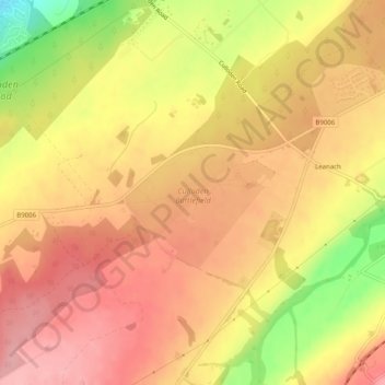
Name: Culloden Battlefield topographic map, elevation, terrain.
Average elevation: 141 m
Minimum elevation: 57 m
Maximum elevation: 185 m
Highland trails, hiking, mountain biking, running and outdoor activities