
Lieksa topographic map
Interactive map
Click on the map to display elevation.
About this map
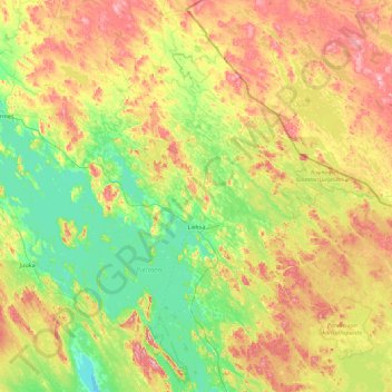
Name: Lieksa topographic map, elevation, terrain.
Average elevation: 153 m
Minimum elevation: 83 m
Maximum elevation: 302 m
Other topographic maps
Click on a map to view its topography, its elevation and its terrain.
Koli
Finland > North Karelia > Lieksa
Koli, Lieksa, Pielinen Karelia, North Karelia, Regional State Administrative Agency for Eastern Finland, Mainland Finland, Finland
Average elevation: 146 m