
Monte Falterona topographic map
Interactive map
Click on the map to display elevation.
About this map
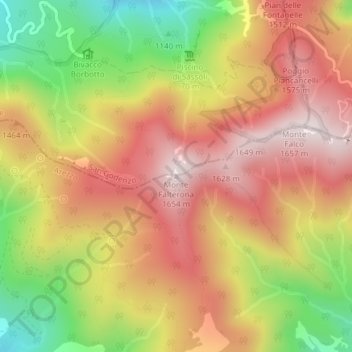
Name: Monte Falterona topographic map, elevation, terrain.
Location: Monte Falterona, Pratovecchio Stia, AR, TOS, 47018, Italia (43.87361 11.69657 43.87371 11.69667)
Average elevation: 1,364 m
Minimum elevation: 1,001 m
Maximum elevation: 1,642 m