
Burano topographic map
Interactive map
Click on the map to display elevation.
About this map
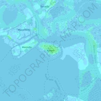
Name: Burano topographic map, elevation, terrain.
Location: Burano, Venice, VE, Veneto, Italy (45.48304 12.41306 45.48764 12.42148)
Average elevation: 0 m
Minimum elevation: -4 m
Maximum elevation: 5 m
Other topographic maps
Click on a map to view its topography, its elevation and its terrain.
Sant'Erasmo
Italy > Veneto > Venice > Sant'Erasmo
Sant'Erasmo, Venice, Venezia, Veneto, Italy
Average elevation: 0 m
Canale di Cannaregio
Canale di Cannaregio, Venice, VE, Veneto, 30121, Italy
Average elevation: 2 m
La Certosa
Italy > Veneto > Venice > Lido
La Certosa, Venezia-Murano-Burano, Lido, Venice, Venezia, Veneto, Italy
Average elevation: 0 m