
Ísafjörður topographic map
Interactive map
Click on the map to display elevation.
About this map
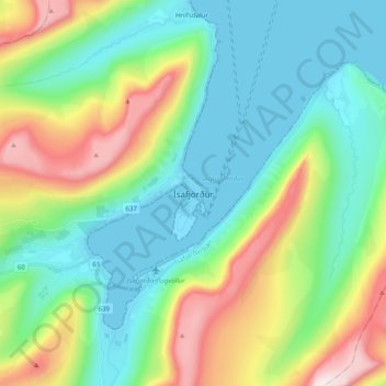
Name: Ísafjörður topographic map, elevation, terrain.
Location: Ísafjörður, Ísafjarðarbær, Westfjords, 400, Iceland (66.03269 -23.15935 66.11269 -23.07935)
Average elevation: 237 m
Minimum elevation: -6 m
Maximum elevation: 818 m
Other topographic maps
Click on a map to view its topography, its elevation and its terrain.
Flateyri
Flateyri, Ísafjarðarbær, Westfjords, 425, Iceland
Average elevation: 90 m