
Santarém topographic map
Interactive map
Click on the map to display elevation.
About this map
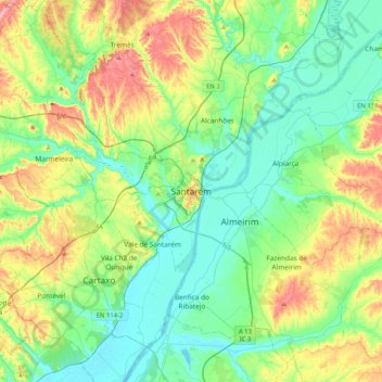
Name: Santarém topographic map, elevation, terrain.
Location: Santarém, Lezíria do Tejo, Alentejo, 2000-024, Portugal (39.07636 -8.84671 39.39636 -8.52671)
Average elevation: 55 m
Minimum elevation: -1 m
Maximum elevation: 189 m