
Bordón topographic map
Interactive map
Click on the map to display elevation.
About this map
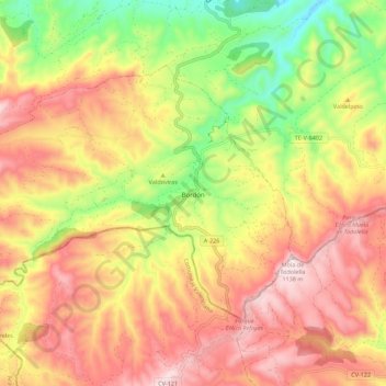
Name: Bordón topographic map, elevation, terrain.
Location: Bordón, Maestrazgo, Teruel, Aragon, Spain (40.65950 -0.40415 40.71522 -0.29352)
Average elevation: 910 m
Minimum elevation: 636 m
Maximum elevation: 1,142 m
Other topographic maps
Click on a map to view its topography, its elevation and its terrain.
Miravete de la Sierra
Spain > Aragon > Maestrazgo
Miravete de la Sierra, Maestrazgo, Teruel, Aragon, Spain
Average elevation: 1,375 m