
Parque Sierra de Alica topographic map
Interactive map
Click on the map to display elevation.
About this map
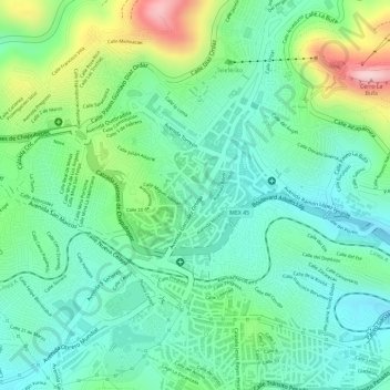
Name: Parque Sierra de Alica topographic map, elevation, terrain.
Location: Parque Sierra de Alica, Zacatecas, México (22.76852 -102.57735 22.77019 -102.57579)
Average elevation: 2,460 m
Minimum elevation: 2,379 m
Maximum elevation: 2,635 m
Other topographic maps
Click on a map to view its topography, its elevation and its terrain.