
Kakslauttanen topographic map
Interactive map
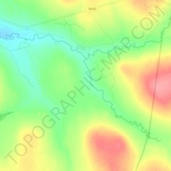
Click on the map to display elevation.
About this map
Name: Kakslauttanen topographic map, elevation, terrain.
Average elevation: 301 m
Minimum elevation: 265 m
Maximum elevation: 348 m
Other topographic maps
Click on a map to view its topography, its elevation and its terrain.
Urho Kekkonen National Park
Finland > Northern Finland > Sodankylä > Sodankylä
Urho Kekkonen National Park, Piettämäntie, Sodankylä, Pohjois-Lapin seutukunta, Lapland, Northern Finland, Mainland Finland, Finland
Average elevation: 271 m