
Dhankuta topographic map
Interactive map
Click on the map to display elevation.
About this map
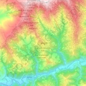
Name: Dhankuta topographic map, elevation, terrain.
Location: Dhankuta, Koshi, Eastern Development Region, Nepal (26.91704 87.27154 27.04913 87.38295)
Average elevation: 1,066 m
Minimum elevation: 226 m
Maximum elevation: 2,247 m