
Worthington topographic map
Interactive map
Click on the map to display elevation.
About this map
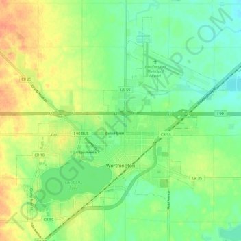
Name: Worthington topographic map, elevation, terrain.
Location: Worthington, Nobles County, Minnesota, 56187, United States (43.60095 -95.64349 43.66983 -95.53271)
Average elevation: 485 m
Minimum elevation: 468 m
Maximum elevation: 506 m
Other topographic maps
Click on a map to view its topography, its elevation and its terrain.
Lismore
United States > Minnesota > Nobles County
Lismore, Nobles County, Minnesota, United States
Average elevation: 510 m
Round Lake
United States > Minnesota > Nobles County
Round Lake, Nobles County, Minnesota, 56167, United States
Average elevation: 472 m