
Hook topographic map
Interactive map
Click on the map to display elevation.
About this map
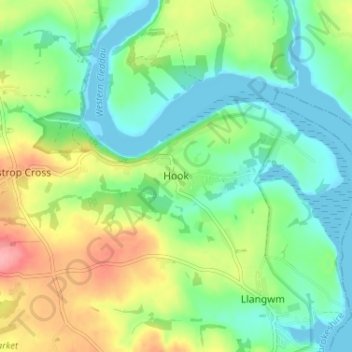
Name: Hook topographic map, elevation, terrain.
Location: Hook, Pembrokeshire, Wales, SA62 4NB, United Kingdom (51.74313 -4.95070 51.78313 -4.91070)
Average elevation: 34 m
Minimum elevation: -2 m
Maximum elevation: 99 m