
Kingston topographic map
Interactive map
Click on the map to display elevation.
About this map
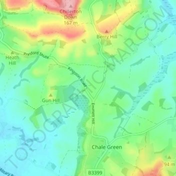
Name: Kingston topographic map, elevation, terrain.
Average elevation: 68 m
Minimum elevation: 29 m
Maximum elevation: 167 m
Other topographic maps
Click on a map to view its topography, its elevation and its terrain.
Hazelbury Bryan
United Kingdom > England > Kingston
Hazelbury Bryan, Kingston, Dorset, South West England, England, United Kingdom
Average elevation: 91 m