
Wattons Mill topographic map
Interactive map
Click on the map to display elevation.
About this map
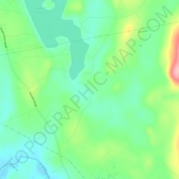
Name: Wattons Mill topographic map, elevation, terrain.
Location: Wattons Mill, Knox County, Maine, USA (44.15313 -69.25393 44.19313 -69.21393)
Average elevation: 55 m
Minimum elevation: 6 m
Maximum elevation: 163 m