

KLCC Park topographic map
Click on the map to display elevation.
KLCC Park
The park was designed to showcase a heritage of tropical greenery by integrating man's creation with nature. The park itself contrasts as a calm environment in the midst of the hustle and bustle of the city. The park features many combinations of man-made design such as cements, water features and also natural features such as trees, shrubs, stones and wood. Elements of shape and topography were created to give an illusion of space. The combination of trees, shrubs and sculptures were arranged to provide color and form to the park.
About this map
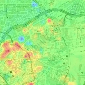
Name: KLCC Park topographic map, elevation, terrain.
Location: KLCC Park, Kampung Cendana, Kuala Lumpur, 50088, Malaysia (3.15402 101.71218 3.15722 101.71740)
Average elevation: 46 m
Minimum elevation: -52 m
Maximum elevation: 96 m