
Lugala topographic map
Interactive map
Click on the map to display elevation.
About this map
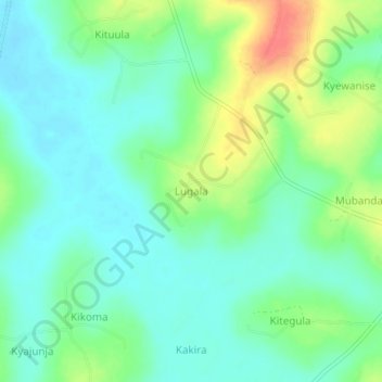
Name: Lugala topographic map, elevation, terrain.
Location: Lugala, Mukono, Central Region, Uganda (0.66333 32.78000 0.70333 32.82000)
Average elevation: 1,080 m
Minimum elevation: 1,061 m
Maximum elevation: 1,119 m