
Khorramabad topographic map
Interactive map
Click on the map to display elevation.
About this map
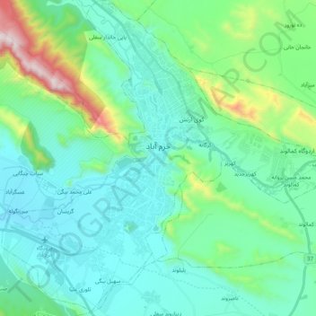
Name: Khorramabad topographic map, elevation, terrain.
Average elevation: 1,365 m
Minimum elevation: 1,125 m
Maximum elevation: 2,391 m
Khorramabad has what is classed under the Köppen climate classification as a Hot-summer Mediterranean climate (Csa) climate. Its elevation is 1147.8 above sea level. Average annual precipitation is 511.06 and its average annual temperature is 17.21 Celsius.