
بومهل البساتين topographic map
Interactive map
Click on the map to display elevation.
About this map
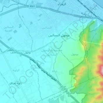
Name: بومهل البساتين topographic map, elevation, terrain.
Location: بومهل البساتين, Ben Arous, 2097, Tunisia (36.69005 10.25324 36.74088 10.32034)
Average elevation: 46 m
Minimum elevation: -3 m
Maximum elevation: 403 m
Other topographic maps
Click on a map to view its topography, its elevation and its terrain.
برج السدرية
برج السدرية, معتمدية حمام الشط, Ben Arous, Tunisia
Average elevation: 156 m
بومهل البساتين
Tunisia > Ben Arous > بومهل البساتين
بومهل البساتين, بومهل, معتمدية بومهل البساتين, Ben Arous, 2097, Tunisia
Average elevation: 47 m