
Torsa topographic map
Interactive map
Click on the map to display elevation.
About this map
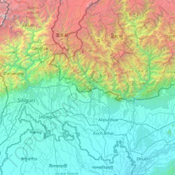
Name: Torsa topographic map, elevation, terrain.
Location: Torsa, Samtse Dzongkhag, Samtse District, Bhutan (25.82562 88.81307 27.89474 89.77937)
Average elevation: 1,477 m
Minimum elevation: 20 m
Maximum elevation: 8,582 m
Other topographic maps
Click on a map to view its topography, its elevation and its terrain.
Gomtu
Bhutan > Samtse District > Phuentshogpelri Gewog > Jangchhogling Lachhungthang
Gomtu, Jangchhogling Lachhungthang, Phuentshogpelri Gewog, Samtse District, Bhutan
Average elevation: 392 m