
Wickliffe topographic map
Interactive map
Click on the map to display elevation.
About this map
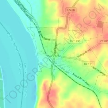
Name: Wickliffe topographic map, elevation, terrain.
Location: Wickliffe, Ballard County, Kentucky, United States (36.95573 -89.09780 36.97474 -89.06950)
Average elevation: 110 m
Minimum elevation: 85 m
Maximum elevation: 143 m
Other topographic maps
Click on a map to view its topography, its elevation and its terrain.
Slater
United States > Kentucky > Ballard County
Slater, Ballard County, Kentucky, United States
Average elevation: 135 m
Barlow
United States > Kentucky > Ballard County
Barlow, Ballard County, Kentucky, United States
Average elevation: 110 m
Kevil
United States > Kentucky > Ballard County
Kevil, Ballard County, Kentucky, United States
Average elevation: 132 m
La Center
United States > Kentucky > Ballard County
La Center, Ballard County, Kentucky, United States
Average elevation: 111 m