
Elton-on-the-Hill topographic map
Interactive map
Click on the map to display elevation.
About this map
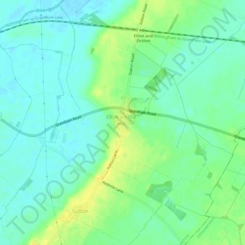
Name: Elton-on-the-Hill topographic map, elevation, terrain.
Average elevation: 29 m
Minimum elevation: 20 m
Maximum elevation: 42 m
Other topographic maps
Click on a map to view its topography, its elevation and its terrain.
East Leake
United Kingdom > England > Rushcliffe > Nottinghamshire > East Leake
East Leake, Station Road, East Leake, Rushcliffe, Nottinghamshire, East Midlands, England, LE12 6LA, United Kingdom
Average elevation: 62 m
Cropwell Bishop
United Kingdom > England > Rushcliffe > Nottinghamshire
Cropwell Bishop, Rushcliffe, Nottinghamshire, East Midlands, England, United Kingdom
Average elevation: 49 m
Kingston on Soar
United Kingdom > England > Rushcliffe > Nottinghamshire
Kingston on Soar, Rushcliffe, Nottinghamshire, East Midlands, England, United Kingdom
Average elevation: 39 m