
Campton topographic map
Interactive map
Click on the map to display elevation.
About this map
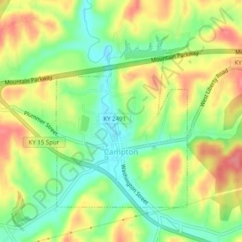
Name: Campton topographic map, elevation, terrain.
Location: Campton, Wolfe County, Kentucky, 41303, United States (37.72801 -83.55659 37.74727 -83.53778)
Average elevation: 323 m
Minimum elevation: 287 m
Maximum elevation: 363 m
Other topographic maps
Click on a map to view its topography, its elevation and its terrain.
Mary
United States > Kentucky > Wolfe County
Mary, Wolfe County, Kentucky, 41301, United States
Average elevation: 299 m
Torrent
United States > Kentucky > Wolfe County
Torrent, Wolfe County, Kentucky, 41303, United States
Average elevation: 345 m