
Wallasea Island topographic map
Interactive map
Click on the map to display elevation.
About this map
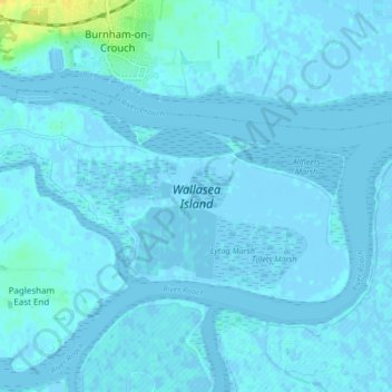
Name: Wallasea Island topographic map, elevation, terrain.
Average elevation: 1 m
Minimum elevation: -7 m
Maximum elevation: 21 m
Other topographic maps
Click on a map to view its topography, its elevation and its terrain.
Rochford
United Kingdom > England > Rochford
Rochford, Essex, England, United Kingdom
Average elevation: 26 m
Hockley
United Kingdom > England > Rochford
Hockley, Rochford, Essex, England, United Kingdom
Average elevation: 35 m
Great Wakering
United Kingdom > England > Rochford
Great Wakering, Rochford, Essex, England, United Kingdom
Average elevation: 1 m
River Roach
United Kingdom > England > Rochford
River Roach, Rochford, Essex, East of England, England, SS6 8YW, United Kingdom
Average elevation: 45 m