
Sisseton topographic map
Interactive map
Click on the map to display elevation.
About this map
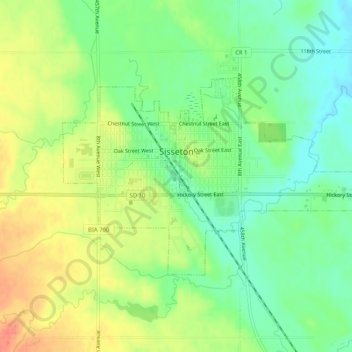
Name: Sisseton topographic map, elevation, terrain.
Average elevation: 376 m
Minimum elevation: 354 m
Maximum elevation: 402 m
Other topographic maps
Click on a map to view its topography, its elevation and its terrain.
Summit
United States > South Dakota > Roberts County > Summit
Summit, Roberts County, South Dakota, United States
Average elevation: 609 m
Sisseton
United States > South Dakota > Roberts County > Sisseton
Sisseton, Long Hollow District, Roberts County, South Dakota, 57262, United States
Average elevation: 381 m