
Monte Plata topographic map
Interactive map
Click on the map to display elevation.
About this map
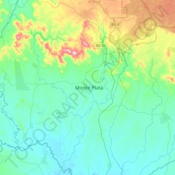
Name: Monte Plata topographic map, elevation, terrain.
Location: Monte Plata, Dominican Republic (18.65006 -69.94754 18.97006 -69.62754)
Average elevation: 109 m
Minimum elevation: 8 m
Maximum elevation: 498 m