
Kangchenjunga topographic map
Interactive map
Click on the map to display elevation.
About this map
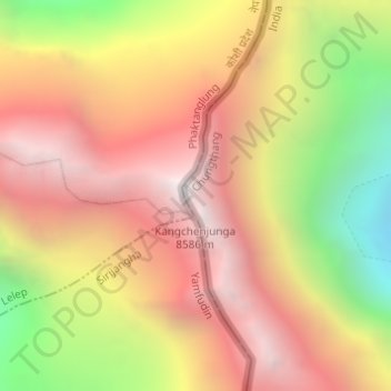
Name: Kangchenjunga topographic map, elevation, terrain.
Average elevation: 7,724 m
Minimum elevation: 6,502 m
Maximum elevation: 8,587 m
Kangchenjunga Main is the highest elevation of the Brahmaputra River basin, which forms part of the southeast Asian monsoon regime and is among the globally largest river basins. Kangchenjunga is one of six peaks above 8,000 m (26,000 ft) located in the basin of the Kosi River, which is among the largest tributaries of the Ganges. The Kangchenjunga massif forms also part of the Ganges Basin.