
Бурец topographic map
Interactive map
Click on the map to display elevation.
About this map
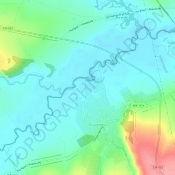
Name: Бурец topographic map, elevation, terrain.
Average elevation: 87 m
Minimum elevation: 64 m
Maximum elevation: 159 m
Other topographic maps
Click on a map to view its topography, its elevation and its terrain.
Бурец
Russia > Tatarstan > Кошкинское сельское поселение
Бурец, Кошкинское сельское поселение, Kukmorsky District, Tatarstan, Volga Federal District, 422104, Russia
Average elevation: 87 m