
Chifeng topographic map
Interactive map
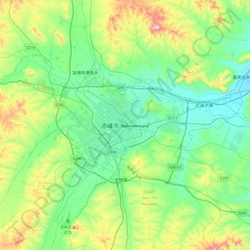
Click on the map to display elevation.
About this map
Name: Chifeng topographic map, elevation, terrain.
Average elevation: 660 m
Minimum elevation: 515 m
Maximum elevation: 1,069 m
Chifeng is situated along the upper reaches of the Xiliao River. Within its area are the southwesternmost extension of the Greater Khingan, the Inner Mongolia Plateau as well as the Xiliao River Plain, and finally the northernmost extent of the Yan Mountains. Bordering prefecture-level divisions are Tongliao to the northeast, Chaoyang (Liaoning) to the southeast, Chengde (Hebei) to the south, and the Xilingol League and to the west. From north to south Chifeng City stretches 457.5 km (284.3 mi), while from east to west it stretches 375 km (233 mi). Elevations decrease from a high of 2,067 m (6,781 ft) in the west to less than 300 m (980 ft) in the east.