
Tychy topographic map
Interactive map
Click on the map to display elevation.
About this map
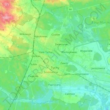
Name: Tychy topographic map, elevation, terrain.
Location: Tychy, GZM, Silesian Voivodeship, Poland (50.07717 18.92527 50.17583 19.09152)
Average elevation: 258 m
Minimum elevation: 230 m
Maximum elevation: 336 m
Other topographic maps
Click on a map to view its topography, its elevation and its terrain.
Tychy
Poland > Silesian Voivodeship > Tychy
Tychy, Górnośląsko-Zagłębiowska Metropolia, Silesian Voivodeship, Poland
Average elevation: 256 m