
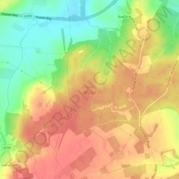
Clowes Wood topographic map
Interactive map
Click on the map to display elevation.
About this map
Name: Clowes Wood topographic map, elevation, terrain.
Location: Clowes Wood, Blean, Canterbury, Kent, England, United Kingdom (51.31237 1.03234 51.34191 1.07062)
Average elevation: 53 m
Minimum elevation: 15 m
Maximum elevation: 78 m
Other topographic maps
Click on a map to view its topography, its elevation and its terrain.
Honey Hill
United Kingdom > England > Kent > Canterbury > Blean
Honey Hill, Blean, Canterbury, Kent, England, CT5 3BP, United Kingdom
Average elevation: 61 m